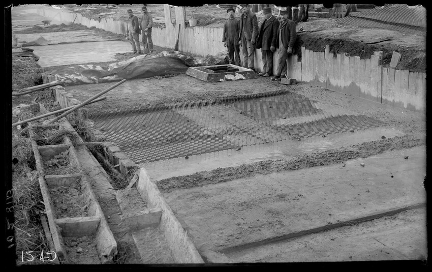
Sewer construction at Porter Street, looking west, East Boston, Boston, Mass., 10263-B Sewer construction into harbor at Porter Street, looking east, East Boston, Boston, Mass., 10264-B Outlet drain to storage basin, east end of outlet drain, looking northeast, East Boston, Boston, Mass., 10265-B Prescott Street abutments, looking north, construction of yard at piers, East Boston, Boston, Mass., 10266-B Prescott Street east abutment looking south, construction of yard near piers, East Boston, Boston, Mass., 10267-B Prescott Street, 30" drain rear of east abutment looking north, building yard near piers, East Boston, Boston, Mass., 10268-B Prescott Street footbridge, looking north, building yard near piers, East Boston, Boston, Mass., 10269-B East wall north of Saratoga Street, showing cement mixer, locomotive and railroad cars, East Boston, Boston, Mass., 10270-B Trench north of Saratoga Street, looking south, East Boston, Boston, Mass., 10271-B Concrete mixer, steam shovel, trench and sheathing between Curtis and Saratoga Streets, East Boston, Boston, Mass., 10272-B Trench and retaining wall, east side, north of Saratoga Street, East Boston, Boston, Mass., 10273-B Trench on east side and west abutment wall at Curtis Street crossing, East Boston, Boston, Mass., 10274-B East wall at old bulkhead, north of Saratoga Street, East Boston, Boston, Mass., 10275-B Bank of earth north of Curtis Street, west side, East Boston, Boston, Mass., 10276-B Looking south, vicinity of piers, East Boston, Boston, Mass., 10277-B Children on street corner, East Boston, Boston, Mass., 10278-B Prescott Street Railroad Yard, Grand Junction Branch, looking east from Prescott Street, East Boston, Boston, Mass., 10279-B General view at Saratoga Street, looking north, showing railroad cars, East Boston, Boston, Mass., 10280-B Storage basin, looking southwest from extreme north end, showing construction of roof with expanded metal, East Boston, Boston, Mass., 10281-B Storage basin, north end of work looking northwest, dump tracks, East Boston, Boston, Mass., 10282-B Storage basin, south end of work looking northeast, city pile driver at work, East Boston, Boston, Mass., 10283-B Bennington Street, east abutment looking north, East Boston, Boston, Mass., 10284-B Sewer at Porter Street, bottom looking east, East Boston, Boston, Mass., 10285-B Steam shovel in cut at south end of storage basin, looking south, East Boston, Boston, Mass., 10286-B View near Sumner Street, East Boston, Boston, Mass., 10287-B View of old station looking down West Street, Pittsfield, Mass., 10438-B Old station from track side, vintage train, Pittsfield, Mass., 10439-B Old station, excavation for new station on right, Pittsfield, Mass., 10440-B Old station looking east, New Haven Railroad tracks on right, New York Central (Boston & Albany) on left, Pittsfield, Mass., 10441-B New station marquee, Pittsfield, Mass., 10442-B McCabe's derrick removing old overhead footbridge, Pittsfield, Mass., 10443-B McCabe's derrick car placing long span for new overhead footbridge, Pittsfield, Mass., 10444-B McCabe's derrick car placing long span for new overhead footbridge, Pittsfield, Mass., 10445-B New overhead footbridge, old footbridge in background, looking west, Pittsfield, Mass., 10446-B Broken dam as a result of flooding of the Westfield River in Berkshire Mountains, Middlefield, Mass., 10447-B Tower #6 looking west from vicinity of Exeter Street, Exeter Street passenger coach yard at Huntington Avenue, freight yard at left, Boston, Mass., 10448-B Exposed after flooding of Westfield River in Berkshire Mountains, Middlefield, Mass., 10449-B After flooding of Westfield River, Middlefield, Mass., 10450-B Damage of flooding of Westfield River, Middlefield, Mass., 10451-B Westfield River flood damage, Middlefield, Mass., 10452-B Westfield River flood damage, Middlefield, Mass., 10453-B Westfield River flood damage, Middlefield, Mass., 10454-B Washed out roadway over dam after flooding of Westfield River, Middlefield, Mass., 10455-B Washouts along Westfield River after flood, Middlefield, Mass., 10456-B Broken dam and roadway over Westfield River after flood, Middlefield, Mass., 10457-B After flood receded, area covered by lake formed by collapsed dam, Middlefield, Mass., 10458-B Flood damage, sluiceway gates, Middlefield, Mass., 10459-B Results of flooding of Westfield River in Berkshire Mountains, Middlefield, Mass., 10460-B Damage caused by flooding of Westfield River in Berkshire Mountains and washed out Boston & Albany railroad, Middlefield, Mass., 10461-B Results of flooding of Westfield River, washed out railroad bridge in right background with temporary trestle, Middlefield, Mass., 10462-B